
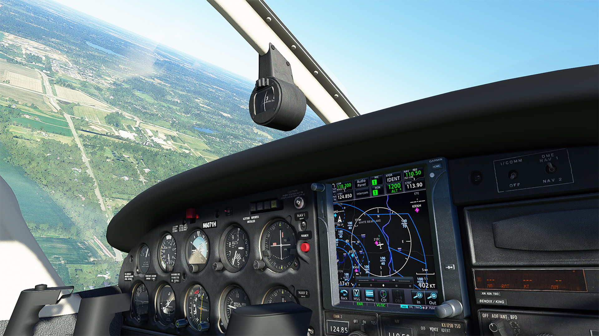
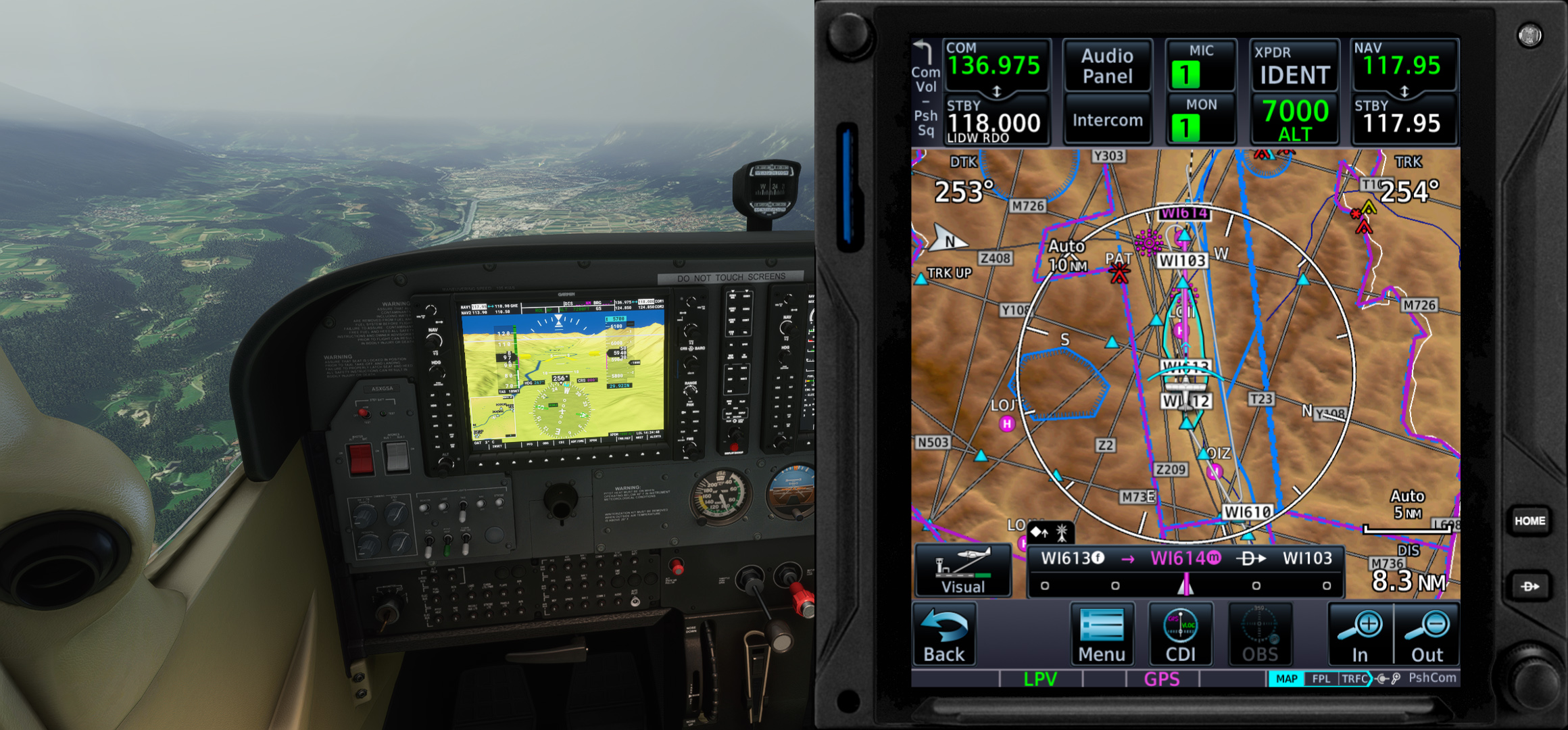
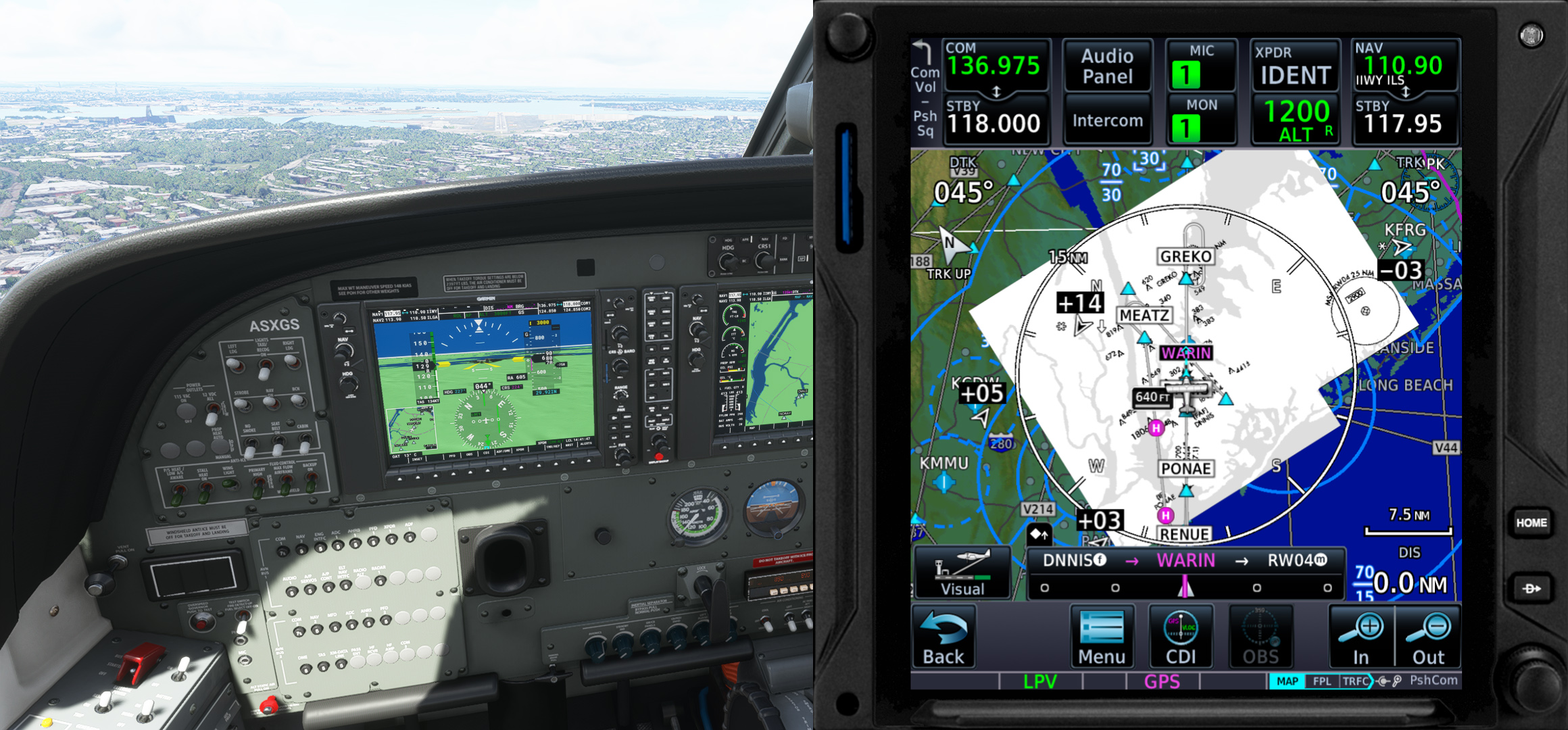
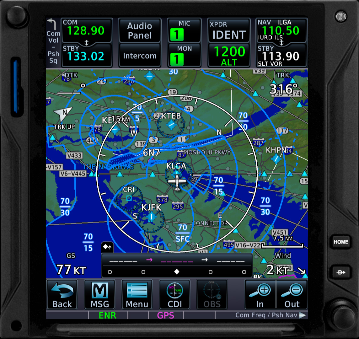
Η TDS Sim παρουσίασε την νέα έκδωση GTNXi 750/650 για το MSFS!
Αυτή η λύση μπορεί να τρέξει σε ξεχωριστό παράθυρο εκτός του simulator. Μπορείτε δηλαδή να το βάλετε και σε μια άλλη οθόνη η με προγράμματα όπως το spacedesk ακόμα κ στο iPad. Είναι πολύ βολικό έτσι στην χρήση, καθώς με ένα απλό click/touch μπορείτε να ρυθμίσετε τα πάντα. Είτε πληροφορίες από τον χάρτη, είτε Direct-To, ακόμα και αλλαγή Flight Plan “on-the-fly”. Υποστηρίζει μέχρι και το πληκτρολόγιο σας για input.
Πλέον όμως, υπάρχει και πλήρη υποστήριξη ενσωμάτωσης του GPS μέσα στο σκάφος. Μια λίστα των addons που υποστηρίζουν -και θα υποστηρίξουν- αυτή την ενσωμάτωση υπάρχει στο https://tdssim.com/gtnxivcintegration. Επίσης, κάθε developer μπορεί να ζητήσει να του δοθούν οδηγίες για το πως να το ενσωματώσει και στο δικό του addon.
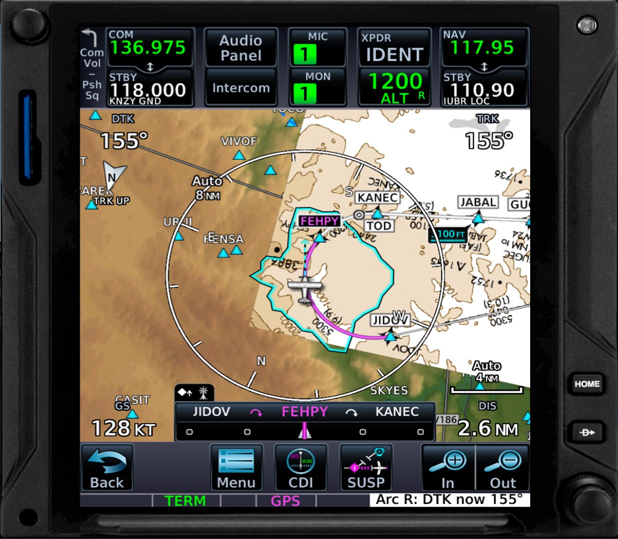
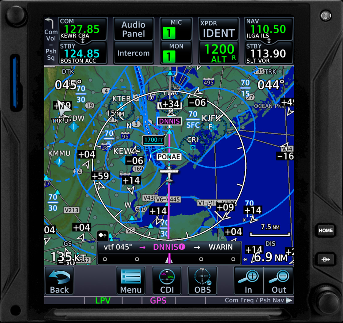
Πέρα από τα άπειρα features, που μπορείτε παρακάτω να διαβάσετε «ανοίγοντας» τα ανάλογα κεφάλαια, υποστηρίζει πλήρες Autopilot Coupled LPV Approaches, new style Visual Approaches, RF Procedure Legs (Next Generation radius-to-fix) και σας δείχνει σε «real-time» και ένα Glide Range Ring στον χάρτη!
Όποιος θέλει να δει όλα τα features και πως ακριβώς γίνεται η εγκατάσταση προτού αγοράσει το addon, έχει την δυνατότητα να διαβάσει το επίσημο manual στο https://tdssim.com/Downloads/Manuals/TDSGTNXiFlightSimManual.pdf
Η παλιά έκδοση είχε κάποια προβλήματα με τον αυτόματο πιλότο. Όπως πχ. το τρεμουλιαριζμα που βλέπετε εδώ στο βιντεο. Τώρα όμως ο αυτόματος πιλότος δουλεύει χωρίς περιορισμούς και χωρίς ανεπιθύμητες συμπεριφορές η κολλήματα.

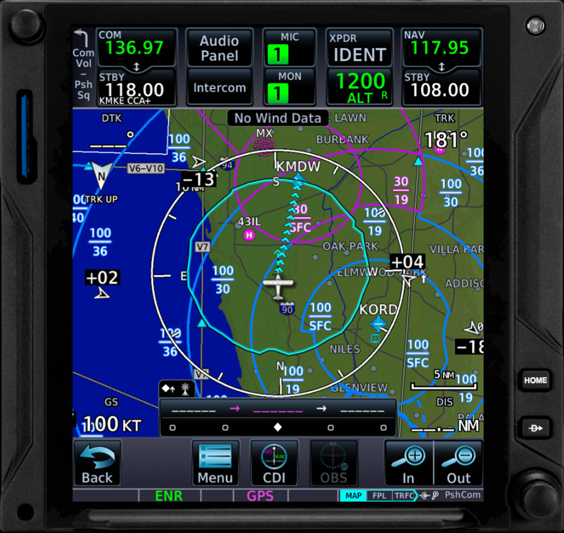
- Ultra-high-resolution mapping, terrain information, mapping features: water bodies, political borders, roads, cities
- All the navigation data that you are used to: airports, waypoints, VOR/NDBs
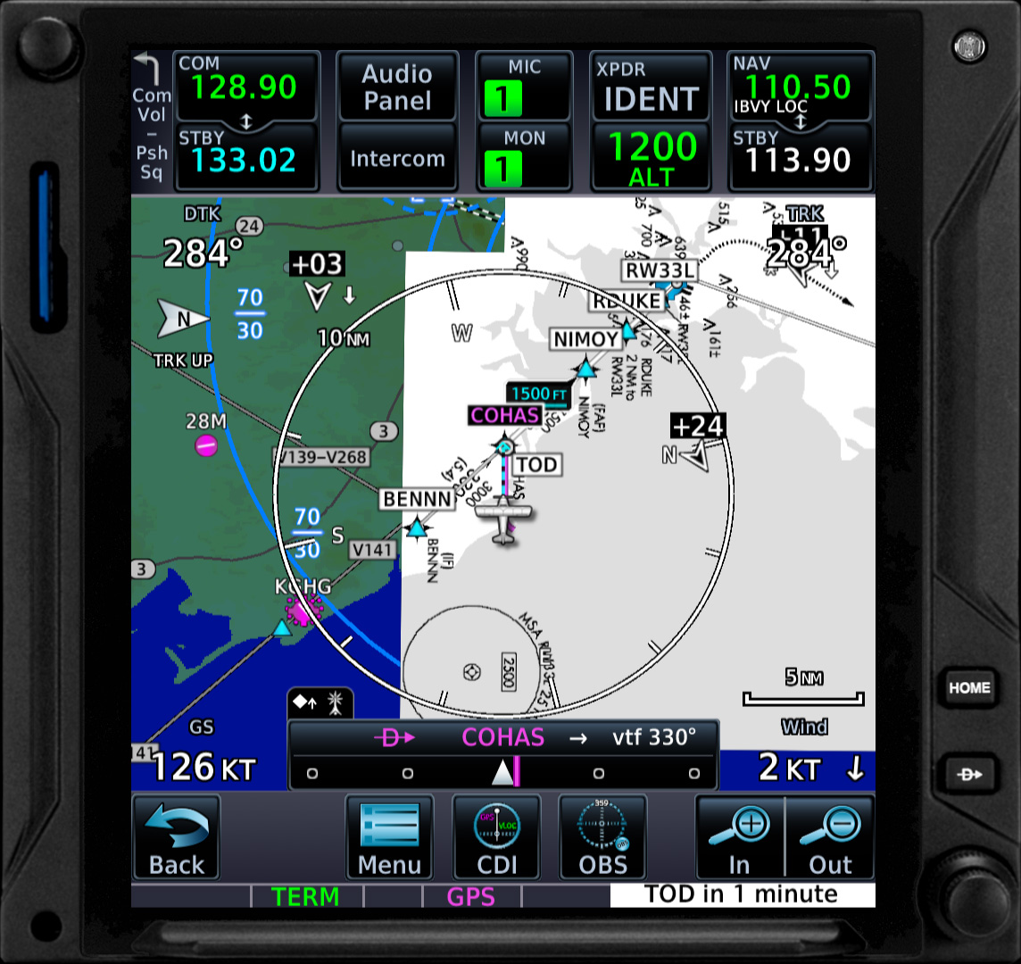
- Airport’s diagram including taxiways
- Geo-referenced charts to assist in perfectly flying that navigation procedure (approach, arrival, departure)
- One virtual tap on the map, one push of the D-TO key and the GTN will fly you to that waypoint!
- Obstacle and wire data
- A wealth of airspaces: Class A, B, C, D, SUA, along with Smart Airspaces
- Terrain elevation data and TAWS A/B Alerts in case of CFIT (Controlled Flight Into Terrain)
- Custom User Waypoints and Visual Reporting Points
- Graphical flight planning: ability to create and modify a flight plan on the fly, from within the map
- One virtual tap on the map, one push of the D-TO key and the GTN will fly you to that waypoint!
- Type in the flight plan waypoints on the screen using the virtual keyboard, with the user option of an Alphabetical or QWERTY keyboard
- Ability view the active leg status and bearing/distance data to flight plan waypoints
- Ability to save flight plans in a catalog format and import community/user created flight plan flies
- Fly a parallel course offset
- Loading airways into the active flight plan is as easy as three virtual touches
- Direct-To ability to any waypoint, along with flying unpublished holds, multiple search and rescue patterns
- Ability to load and activate procedures (approaches, arrivals, departures), from a worldwide list of airports
- Basic VNAV descent profile, doing all the math calculations for you, displaying a message when to begin your descent, so you can reach the target waypoint at the desired altitude
- It offers the ability to virtually type in any COM/NAV frequency
- Quickly change between the standby and active frequency with the tap of a virtual key
- A smart unit: the GTNXi keeps a list of the recent and favorite frequencies
- Ability to quickly tune nearest or flight plan frequencies
- Integrated ADS-B Transponder with the ability to change the transponder mode, having an ADS-B transponder permits the map to show ADS-B targets, thus enhancing the safety
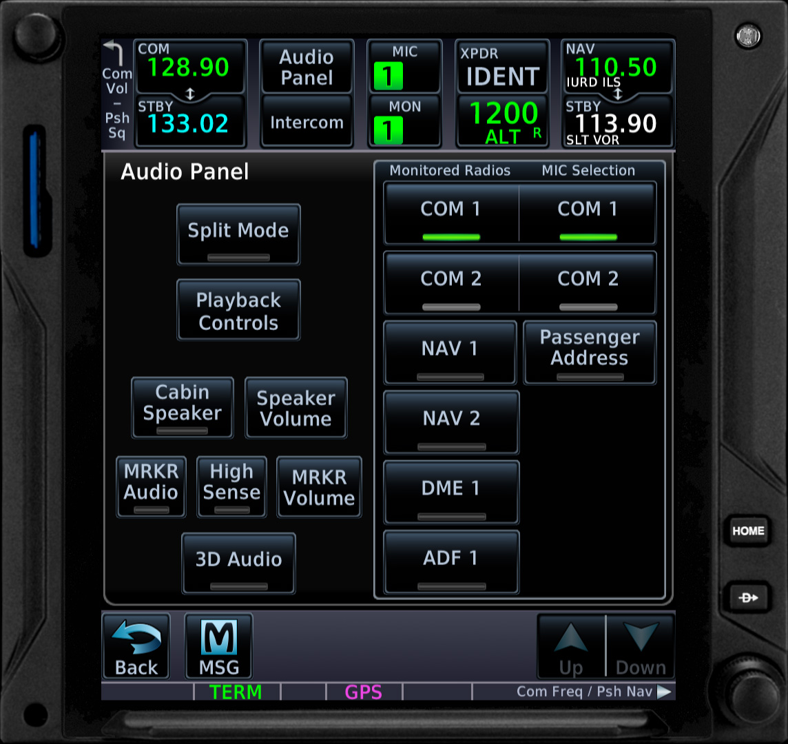
- Full Audio Panel allowing to select the COM receiver and multiple monitoring audio sources: NAV1/2, ADF, DME, Marker Sound
- Dimmable display brightness from within the Utilities menu
- Adjustable sound volume from within the Utilities menu
- COM Frequency Spacing 8.33 kHz support
- Selected Altitude Range Arc displayed on the Map, using Flight Simulator Autopilot data
- Glide Range Ring and Nearest Airport Indication Arrows to guide you to a safe ladning in case of an engine failure
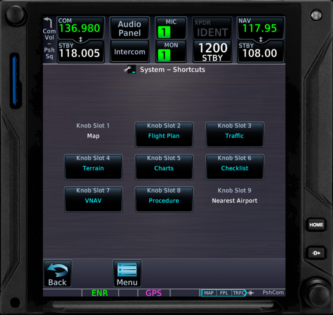
- Rotating Knob Page Selection Configuration
- Ability to fly full RF Procedure Legs (Next Generation radius-to-fix) which give the pilot greater access to airports with challenging terrain
Ένα βίντεο της αρχικής (παλιά) έκδοσης εν δράση θα βρείτε παρακάτω σε review του ΕΗviator
Για αγορά και περισσότερες πληροφορίες για Release, επισκεφτείτε την σελίδα https://tdssim.com/.


